Apple extends new Maps features across U.S.

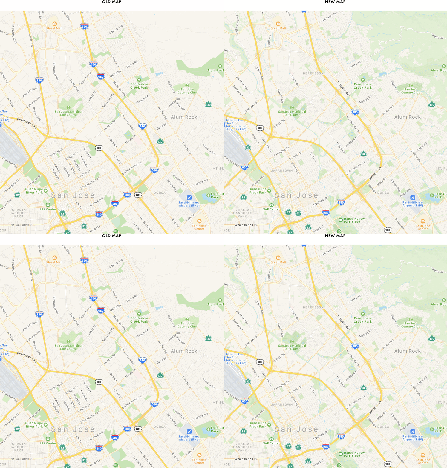
The difference between old Apple Maps and new
Apple last year began publishing excellent improvements to Apple Maps, though these were only made available in a small part of the U.S., but it has now added dozens of new locations to its improved list.
Apple adds lots of indoor maps
These maps are more responsive to changes in roads, more visually rich and feature nice touches, such as detailed ground cover, pedestrian pathways and more.
Apple is working to make them much more informative – more capable of directing you to the front door of your destination, for example. It began working on this project way back in 2014 and opened its it new Maps development hub in Hyderabad, India.
Indoor maps aren’t available everywhere, but as you zoom into a location you will see inside maps appear if they are available. You may see a number in a box beside the map, this indicates the floor you are on – tap the number to see if Apple has maps of additional floors.
Here is Apple’s list of indoor maps of malls and airports. Apple has also added speed limit information to maps in Canada and transit direction in additional U.S. states.
Additional flyover territories
Apple has made 3D Flyover maps available across 50 new locations, including 14 in the U.S, such as Charleston, South Carolina; Lake Tahoe, California; and Key West, Florida.
The compaby has also introduced Flyovr maps to a whole bunch of places outside the U.S. including Twelve Apostles in southern Australia; Queenstown, New Zealand; and Himeji, Japan.
To get to Flyover:
- Navigate to a location on the Map
- Tap the small I icon and choose Satellite on the next page
- Return to the Map and tap 3D
- You can now zoom in and travel around the 3D map to your heart’s content.
Also look out for a Flyover Tour button. This feature isn’t available in every map, but you’ll often find it around big cities and places of interest. It takes the form of a 3D tour around the location.
[amazon_link asins=’0008258341′ template=’ProductCarousel’ store=’playlistclub-21′ marketplace=’UK’ link_id=’b72e6e3d-1416-11e9-9acd-c1994ef9aa26′]
New locations
Here is the list of new Flyover locations added in this update:
- Aix-en-Provence, France
- Aizuwakamatsu, Japan
- Albuquerque, NM
- Cannes, France
- Charleston, SC
- Cincinnati, OH
- Collioure, France
- Foxboro, MA
- Freeport, Bahamas
- Granada, Spain
- Gifu, Japan
- Greensboro, NC
- Hikone, Japan
- Himeji, Japan
- Infantes, Spain
- Izumo, Japan
- Izushi, Japan
- Joshua Tree National Park
- Kahului, HI
- Kanazawa, Japan
- Kapaa, HI
- Key West, FL
- Kitakyushu, Japan
- Kōya, Japan
- Lahaina, HI
- Lake Tahoe, CA
- Lens, France
- Lihue, HI
- Matsumoto, Japan
- Monaco
- Nara, Japan
- Naha, Japan
- Odawara, Japan
- Padua, Italy
- Preston, England
- Queenstown, New Zealand
- Reggio Di Calabria, Italy
- Remoulins, France
- Sakai, Japan
- Siracusa, Italy
- Takahashi, Japan
- Takamatsu, Japan
- Tōjinbō, Japan
- Toledo, OH
- Treviso, Italy
- Tsu, Japan
- Twelve Apostles
- Valladolid, Spain
- Wailua, HI
- Yokkaichi, Japan
- Zaragoza, Spain
Via: MR


I would like to see improvements to traffic reports, such as congestion. It is still difficult to see which side of a freeway or interstate has congested areas.